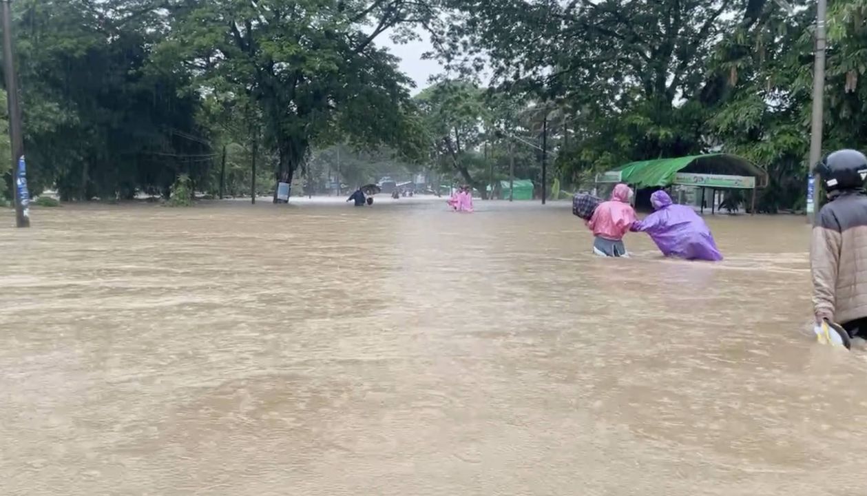
The worsening flood situation in Myitkyina township, Kachin State, has surpassed the danger level mark, trapped thousands of residents and urgently necessitated emergency response.
The rapidly rising waters of the Ayeyarwady River have submerged riverside wards in Myitkyina. A woman from Sitarpu ward told MNJ that residents had to move their belongings to the upper floors of their homes and take shelter there.

“We moved our furniture and belongings from the ground floor to the upper floor, fearing another flood like in 2004. The water level is still gradually rising. Now, we’re taking refuge on the balcony”, she said.
The water level of the Ayeyarwady River has surpassed the 1200 cm danger mark, submerging around 20 wards, including riverside areas, according to aid workers involved in relief efforts. However, the exact severity of the flood situation in the town has yet to be confirmed.
As floodwaters also entered the shops, shopkeepers helped each other to save their goods, another Myitkyina resident reported.
"Right now, it doesn't look like the floodwaters will recede quickly. The water level keeps rising. I had to help move the goods from my friend's shop”, she said.
Because of the rapid rise in water levels, many locals could not evacuate in time and became trapped inside their homes.
MNJ attempted to gather information about the flood situation in Myitkyina by contacting local relief organizations by phone. Unfortunately, most of them are unable to answer calls due to heavy workloads and phone network issues, leaving details about the situation of flood-affected residents still unclear.
Based on initial reports, the submerged wards included Sitarpu, Ayesaeti, Thidar, Meinkhain, Dukataung, Yangyiaung, Yuzana, Myaymyint, Aungnang, Rampu, Laekone, Kyatpaungchan, Myothitgyi, Aye Mya Tharyar, Kachinsu, Shwe Nyaungbin, and Pammatee.
Previously, on May 29, rising water levels in the Ayeyarwady River submerged several low-lying areas in Myitkyina, prompting residents to evacuate temporarily.
In Myitkyina, major flooding events also occurred in 1979, 1997 and 2004 as a result of the Ayeyarwady River overflowing its banks.
During the 1979 flood, the water level of the Ayeyarwady River reached 1413 cm, followed by 1411 cm in 1997, and 1407 cm in 2004.
Every time a major deluge occurs in Myitkyina, downtown wards such as Myothitgyi, Rampu, Kyatpaungchan, Shwe Nyaungbin, Sitarpu, Laekone, Kyunpinthar, and Kachinsu usually bear the brunt.
U Naing Lin Htwe, head of the Department of Meteorology and Hydrology of Kachin State, reported on social media that as of 8:30 AM today, the Ayeyarwady River in Myitkyina had risen to 1330 cm, which is 4 feet above the danger mark of 1200 cm, and the water level continues to rise at an average rate of 3 inches per hour.