Stone pillars will be put in place to demarcate the border between Chin State and Sagaing Region in accordance with maps dating back to 1938, a state minister said.
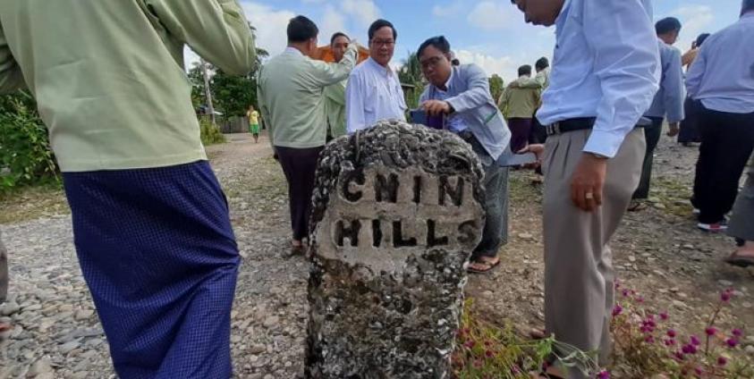
Mang Hil Dar, the Minister of Agriculture, Livestock, Forestry and Mines for Chin State, said that the stone pillars were originally set up between 1935 and 1938 by the British, who controlled Burma at that time.
“We will base it on that map,” he said, in reference to a notification released by the British interior ministry in 1938 and later published as a map in 1942. “We will set up new stone pillars at the original place,” he added.
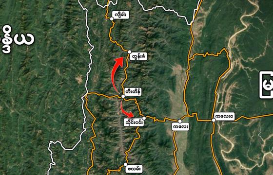
Mang Hin Dar has been working with his Sagaing Region counterpart Kam Za Mon and a director of the land department in Naypyidaw regarding the demarcation. They took note of the 21 old stone pillars on October 7 and held a public meeting on the issue in Kham Pat town. The following day, another meeting was held in the village of Yazargyo, and on October 9, a meeting was scheduled in Zo Nom Zan village in Chin State’s Tonzang Township and on Thursday in Kalay, Sagaing Region.
Advocates in Chin State have expressed concern that maps since this time have allocated more land to Sagaing Region, affecting ancestral land use and even polling areas for elections.
“People may have misunderstandings, such as Sagaing Region owns this area or that area. Chin people may feel that we have lost our land. What I want to say is that the people are the owners of these lands,” Liang Tawng, a leader of the Chin Hills Monitoring Group who participated in the study tour on the ground regarding demarcation, told Khonumthung News.
He said that that after the demarcation had been finalized he hoped there would be “no more complications” and that it would be easier to set up polling stations in the area and for government departments work more effectively in the region.


