Chin State civil society organizations (CSOs) calling for greater transparency in Burma have asked that the original demarcation lines between the state and other regions be reinforced.
The CSOs held a central executive committee meeting in Tedim, Chin State, from July 4-5 to discuss the issue.
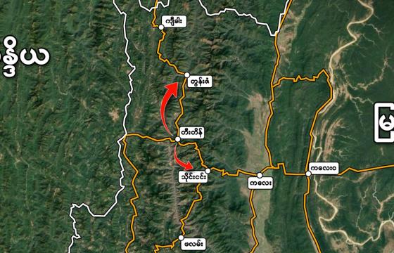
“Chin State has disputes with Sagaing, Magwe and Rakhine State over border demarcation,” Andrew Htar Tawng, who represents Chin State’s branch of Alliance CSOs for Myanmar’s Transparency and Accountability, told Khonumthung News, describing how various maps have shifted these borders over the years. “We want the Union and state governments to solve this demarcation problem between states by using the 1947 map,” he explained, referring to the year before Burma’s independence.
He added that the borders need to be systematically and clearly defined to prevent conflict.
The Alliance said that the campus of Kalay University is an example of an area that straddles multiple borders, but that because of military manipulation of boundaries, the interstate borders are now being incorrectly interpreted.
University documents say that the campus was built on 358 acres of land in Sagaing Region. The Alliance CSOs have said that the university is actually built on 385 acres of land, just over 308 of which are located in Chin State’s Tedim Township and more than 76 of which are in Sagaing’s Kalay Township.
“This information is upside down. The students don’t accept it, and neither do we,” Andrew Htar Tawng said. “We want the Union and state governments to replace the incorrect information with the correct demarcation line because the army has done whatever it has wanted to [concerning the borders].”


